Precipitation is currently the major uncertainty factor in hydrological forecasts. Observing rainfall at a high level of spatial and temporal accuracy will allow significant progress in the management of extreme rainfall in urban areas.
The R2DS RadX@IdF project aims to deepen the comprehension of meteorological phenomena generating precipitation, to carry out pilot experiments and to develop the training of various stakeholders involved in water management in Île-de-France.
A collaborative platform called Forum RadX@IdF will be created to inform and train stakeholders at different levels: local authorities, schools, universities, laboratories, research centres and companies may join the project and access the data that have been collected and validated by the HM&Co researchers. From a longer-term perspective, the RadX@IdF project could lead to the creation of a sub-network of X-band radars to finely control the flow of water and pollutants in the region.
Project Steps
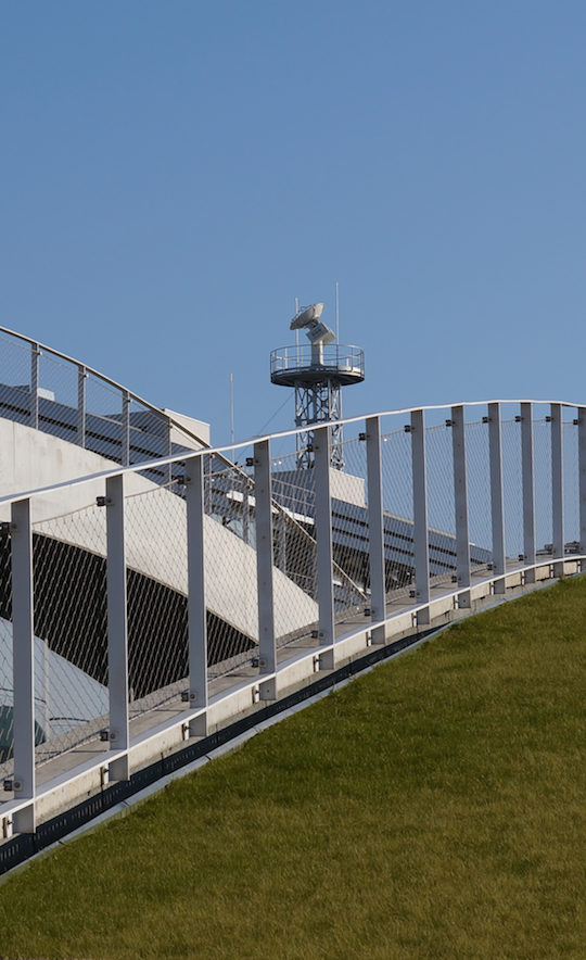
- Install a dual-polarisation X-band radar. Its frequency, which is greater than that of conventional C or S band weather radars, offers many advantages:
-
- the spatial resolution is higher;
- the radar revisit time is faster;
- the diameter of the dish is reduced to 1.80 m;
- investment costs are reduced;
- the rainfall data contamination by ground clutter echoes is reduced.
-
- Launch the radar data distribution platform;
- Validate radar observations;
- Develop and validate new models for real-time prediction of rain and flooding;
- Create a network of synergies among institutional, academic and economic stakeholders in Île-de-France around the RadX@IdF Forum, a platform including a research and training center, an information space on the social contribution of the project and an annual workshop of RadX@IdF users.
- Create a multi-scale observatory to collect data at different range and at different resolution levels. The X-band radar will measure the average rain rate (mm / h), up to about 60 km from its position with a spatial resolution of about 1 hectare. Data on the size and velocity of the raindrops will be collected by a network of disdrometers that will be distributed in an area of about 1 ha. A 3D disdrometer will provide three-dimensional data over a volume of 1 m3. Observing tools at different scales will allow taking into account the high spatial variability, and improving rainfall and flood prediction models.
Photo: Rosa Vicari / HM&Co / École des Ponts ParisTech